Pages

Showing posts with label NPS. Show all posts

Saturday, August 18, 2018

Cadillac Mountain and a Carriage Road Hike

Cadillac Mountain is a 'must see' in Acadia National Park.
Six years ago when we visited we took it the spectacular view from atop Cadillac Mountain.  And we did it again.   We heard this was the first day it wasn't completely overcast.  It still was a bit hazy, but breath-taking anyway.

The small islands in the distance are the 'porcupines'.  A Park Ranger said years ago, the French ships would hide behind and get the jump on approaching British ships.
We left our campground about 7:30 AM and got to the top of the mountain a little after 8:00 AM.  It wasn't too crowded yet and it was easy to find a parking place.
By the time we left, the parking lot was almost full and there were busloads of people taking a look.  Best to go early if you can.

 I always like an orientation map and here is one from the National Park Service:
You can see Cadillac Mountain in the center of the map.  We are camped in Ellsworth that is about 15 miles away (beyond the top of the map).  Cadillac Mountain is in the heart of the Mount Desert Island, Maine's largest and the sixth largest island in the contagious U.S.
The view showed Frenchman's Bay and we could see over to Schoodic Peninsula and more of Acadia National Park.
After our time on the mountain, we ventured down to Eagle Lake and hiked on one of the many Carriage Road trails throughout Acadia.

The Carriage Roads were one of the contributions made by the oil tycoon John D. Rockefeller, Jr.  He bought a home in the Seal Harbor area and spent summers here.  After the national park was established he decided (along with other wealthy people) to buy property and donate it to the park.  He also got wind of the harmful effects of the gasoline powered automobiles and envisioned a system of horse drawn carriage roads throughout the park.  Years later over 57 miles of roads were built under his watchful eye.

Today those Carriage Roads are used by hikers, bikers and a small portion is available for Park-run Carriage Rides.

The parking lot at Eagle Lake is very small so we parked along the side of the road with many others.
We made our way over to the trail head at the corner of the lake and saw about 20-25 high schoolers with their shirts off.  They were from Vermont and had just completed a 10-mile run
After we passed them we started out on our hike and went counter-clock wise around the lake.  We opted for the easy walk with the gradual inclines.
It was mile after mile of walking through beautiful woods next to the lake.  Not exactly sure when this particular Carriage Road was built but it was perfect.  Back in the 1920's or 1930's there may have been fewer trees on the shoreline so we didn't have a lake view the whole walk.
But there were quite a few observation points where we could peak through the trees or step off the road and see some great views.
We started about 10:15 AM so the road wasn't too crowded yet.  There was some steady traffic but plenty of room for everyone.  We say quite a few runners, lots of hikers, and lots and lots of people on bikes.  It was great to see how many families and youngsters were out on the trail.
We went about halfway around the lake and decided to turn around instead of taking on the more difficult west side of the lake Carriage Road.  We saw a space off the trail for a picnic and spent some time enjoying the view.
I figure after our hike on the Carriage Roads, we only have about 54 miles more to go before we see them all.  Doubt that will happen but they are about the best way we know to get in a walk and to have a beautiful walk in the woods.  We love this place!

Thanks for joining us on the Roadrunner Chronicles!


Wednesday, August 15, 2018

Hiking Around Jordan's Pond

This is our second trip to Downeast Maine.  Six years ago we were here over the 4th of July weekend.  It was busy then, but not as busy as it is now.  Despite the crowds we have had a great time the last few days.

We are camped at Forest Ridge Campground in Ellsworth, ME which is about 15 miles from Bar Harbor and Acadia National Park.  One great thing about this lifestyle is seeing friends and meeting new ones.  On Saturday we took a short drive to Orrington, ME which is outside of Bangor.  We arrived at Rick and Barbara's place for a gourmet lunch (Menu - Asian spring roll, cole slaw, corn on the cob, chix lobster) and some catching up time.

Rick and I were in the same unit (Constant Watch PMO) back in the 1980's when we were stationed in Hawaii.  He relocated back here and he and Barbara finished their careers here.  It was great to be able to meet up with them again and enjoy their hospitality.

Earlier in the week, blog readers Randy and Pat, let us know they were camped near us and we got together on Sunday.  We met for the first time at this beautiful church
then went to lunch.  The time passed quickly at Finn's Irish Pub in Ellsworth.  I think we all had fish sandwiches which worked out well.
It was fun hearing about their 18 months on the road and learning of their three kids and what they are up to.  Randy and Pat are from Indiana but moved to Christiansburg VA where they retired and became full-timers.  Check out their blog:  click here

We got together again for some hiking in Acadia National Park around Jordan's Pond.  We drove over to the Visitor Center and took the free (LL Bean supported) bus to Jordan's Pond.
It was misting a little bit and we waited for the rain to let up.  Pam was the only one with a rain coat so the rest of us got a $1 poncho before we started out.
We took the counter clock-wise route and it was a beautiful hike.
 Pat noticed some beautiful tree growth through some rocks.
 We also saw some evidence of beavers at work.
The trail was the busiest hiking we had done in quite a while.  But with the steady stream of traffic, we were able to have a fellow hiker take our picture.
In the distance are the Bubbles.  The North Bubble (left) is 872' and the South (right) is 766'.  We passed near them at the far end of the pond.  At the end of the far end is this cool footbridge.
The first half of the hike took us to the far end of the pond.  On the return, we entered into a more difficult rocky area.
Though I didn't take any pictures, the rocks were part of the actual trail and we slowly hiked a couple hundred yards over them. They were flat and it was it was an easy hike.
Then we traveled along the board trail area.  This portion seemed to go on forever.  It was probably about 1/2 a mile but it required your complete attention.  I was concerned the split logs would be slippery with the light rain but it was not an issue.
Toward the end of the hike, we paused for about 20 minutes and had our picnic lunch off the trail near some rocks.
When we finished, we visited the gift shop again and then boarded the bus for the return trip to the Visitor Center.
 The hike around Jordan Pond is almost a 'must do' while at Acadia National Park.  And it was great spending time with our new friends Randy and Pat.

Thanks for joining us on the Roadrunner Chronicles!


Wednesday, July 23, 2014

A Day at Shiloh and Corinth Battlefields

When we were in Red Bay AL a few weeks ago, we took a day trip to Shiloh National Military Park in Tennessee which also included some time at Corinth, Mississippi.
It was a good three-hour roundtrip, but we took our time and spent most of the day.

Our first impression was that is had some similarities to how Gettysburg National Military Park is set up, though a much smaller version.  It has cemetery area, lots of monuments and a driving tour through the property.

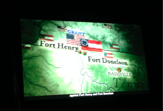
We went over to the Visitor's Center, saw a video and learned of Grant's victories at Fort Henry and Fort Donelson before heading toward his next objective at Corinth.  He landed his troops at Pittsburgh Landing (Shiloh).
After the video, we stopped at the bookstore, then walked over to the cemetery.
After a few minutes there, we were approached by a girl and her friend who asked if we would like to do a local newspaper photo op for them.  We were glad to do so and listened to a local tour guide who gave us some of the history of Shiloh and Corinth.
You can read the article here.  That was fun and an added bonus.

Next our driving tour where we tried to image the flow of the battle and skirmishes.
I always prefer a picture of how one side was pitched against the other.  As an intel analyst from my military days, we tried to present a snapshot of what the battle forces looked like.  As you can imagine, pretty wall map is a far different story than the reality of the chaos on the ground.

Shiloh was an critical location for the Union forces to secure in the bid for the important Confederate railroad junction at Corinth, MS 23 miles to the Southwest.  The battle at Shiloh was the beginning of a six-month siege at Corinth to take control of the railroad and supply centers.

I had started the book months ago but am currently in the process of finishing Personal Memoirs of U. S. Grant - (his autobiography).  Very interesting reading.  Grant was injured when his horse fell on him during the heavy rains and heat of the battle.  The battle at Shiloh (or Pittsburgh Landing) on the Tennessee River was the first major battle won in the Western Theater.

On April 6 and 7, 1862 Union forces (65,000) under U.S. Grant and D.C. Buell were surprised by those of A.S. Johnston and P.G.T. Beauregard (40,000).  Combined dead approached 24,000.  Hard to fathom what war is like if you've never been in one.  Union forces prevailed at Shiloh while the Confederates retreated toward Corinth.

After our driving tour around the battlegrounds, we had lunch under a big shade tree at what was once Pittsburgh Landing.
Then we were off to Corinth and our next museum.
Once we got to the Interpretive Center, we saw a number of artifacts embedded in the cement.
It was a unique way to build some curiosity.  And effective.

Inside, it was a collection of good displays and information that told the story of Corinth and its key role in the Civil War.

To the South, it was a vital distribution and supply point at a junction of rail lines going North and South (Ohio and Mobile Railroad) as well as another railroad route going East and West (Memphis and Charleston Railroad).

Confederate General P.G.T. Beauregard again suffered defeat from Union forces, this time under Gen
Henry Halleck.  However, he was able to pull off a hoax and escape in the night prior to the arrival of Union forces.  He boarded the Ohio and Mobile Railroad along with his soldiers, artillery guns and a large amount of supplies.
We walked through the museum and before departing for Red Bay in the late afternoon.  I think this is another one of those places I am going to have to visit again to digest the ebb and flow of battle and  the key events throughout the siege.

It was a great battlefield to see for the first time and I'm glad we took the time to spend some time there.  The National Park Service has done a nice job with it.  My main take away from this and Vicksburg the better understanding of Gen Grant and how he rose to prominence in the Civil War.  That has always been a mystery to me.

Thanks for joining us today on the Roadrunner Chronicles.  Until next time...