Pages

Showing posts with label National Historic Sites. Show all posts

Sunday, November 13, 2016

Atlanta in a Day

We have not spent a lot of time in Atlanta over the years.  In fact the more we talked about going there, we were cautioned about how tough the traffic is going through the area.  Nevertheless, we wanted to see the Jimmy Carter Presidential Library/Museum and the Georgia State Capitol.

When we began planning our five week fall trip to Florida we had to consider a few things in order to make the most of our time there:  We wanted to
  • Go to a few places we hadn't seen rather than concentrate on old favorites,
  • See as many friends as possible depending on how our schedules lined up,
  • Visit as many historical sites and capitols as we could squeeze in, 
  • Get more repairs done in Red Bay,
  • Stay at modestly priced locations,
  • Relax a bit instead of being on the go every other day
With some of those thoughts in mind, we considered Atlanta and all it has to offer.  We weren't kidding ourselves though, and knew that you can't see Atlanta in a day.  Maybe a week if you hit the high points.  But still it has a lot going on and we actually thought we'd devote a couple of days to seeing what we could.

Our first challenge was finding a decent location to see the city.  We were hoping for some RV campgrounds to choose from on the southern side of Atlanta.  There were precious few choices.

We tried to find a U.S. Army Corps of Engineer park that had been recommended but that didn't work out either.  We located and called Red Top State Park which is about 40 minutes north of the city.  Not ideal, but still doable.

Next, we had to pick two or three things to do each day.  We have found if we cram in more than three or four things it becomes 'overload' and we can't learn all we want and digest it all.  We drove from Columbia S.C. through Atlanta (taking the northern I-285 beltway around the city) to Red Top State Park.

Yikes!  Everyone was right - the traffic is tough !!  Lots of crazy semi-aggressive drivers and not a lot of fun at 1:30 PM in the afternoon.  
Still we made it to our very nice site without incident.

Then for Friday we picked out seeing the State Capitol and the Carter Presidential Library.  Depending on how that went maybe we'd see something else downtown.  The next day we planned on seeing Olympic Park, Turner Stadium, the Underground and the Coca-Cola Museum.

But-- we ran into some issues and didn't get to see all of the capitol.  We forgot Veteran's Day was on Friday so none of the government or state offices were open.  But we went ahead anyway and went downtown.  Holidays are the perfect time to find a parking place and walk around the outside of the capitol!

Georgia State Capitol
We saw a few things and were struck at the size of the building.  It is quite a bit bigger than the last capital we saw.
 We peeked in the doors and sure enough - no one there.
We walked around the northwest corner of building and found a statue of Confederate General John B. Gordon.  He was one of Robert E. Lee's most trusted generals.  
After the war served as governor and later as U.S. Senator from Georgia.  Fort Gordon, outside of Augusta, is named after him.

 Outside there are a number of displays describing Georgia historical events surrounding Atlanta.
 These were erected in 1920 by the Daughters of the Confederacy.

 Near those is a statue of our 39th president, Jimmy Carter.
 As we made our way around the building we noticed some maintenance going on in the back.
Three vehicles were parked on the extra wide sidewalk and they had one of the back doors open and were carrying items back and forth.  While that was going on Pam looked across the street and said, "There's the Liberty Bell!"
Sure enough, on the southeast corner of the capitol is the Liberty Plaza.  It is in a place of honor and a great location for public rallies and other outdoor events.
The names of the three signers of the Declaration of Independence were on the back side of the Liberty Wall.
The Liberty Bell replica was on full display and in a prominent place.
It is probably the best display we have seen of the Liberty Bell replica in our travels to date.  The whole area was very well done.

This photo I grabbed off the internet gives a better perspective of Liberty Plaza and its proximity to the capitol building.

From there, we went over the the Jimmy Carter Museum and Presidential Library.  I will save that and some other things we saw in Atlanta for (an)other post(s).

Thanks for joining us today on the Roadrunner Chronicles!


Thursday, August 25, 2016

Little Bighorn National Monument Stop in Montana

After leaving Columbus MT, we wanted to stop at the Little Bighorn National Monument which was a couple hours along I-90.
It was a cloudy day with some rain, but we stopped anyway to see the museum and the grounds.
A national cemetery is on the site on one side of the main building.
Over time, I am learning more and more about the history of the American Indian and the U.S. Government's expansion through the Great Plains.  There were many reasons for encroachments west of the Mississippi, but the lure of a quick fortune meant trappers and fur traders, gold rushers and others looking for a place to homestead, meant treaties with the Indians were broken again and again.

The tensions between the Indians and the white man varied for a number of years, specifically between 1854-1890 in what was known as the Sioux Wars.  The Little Bighorn was one of those battles of the Sioux Wars.

I liked the small but well done museum.  It had a number of interesting artifacts and displays depicting life in the 1870s on the Plains.  The U. S. 7th Cavalry was dispatched to the territory to "get rid of the Indian problem" and Lt. Col. George A. Custer was among the 700 men who fought against approximately 2,000 Lakota Sioux, Cheyenne and Arapaho warriors.
Custer's Last Stand is the source of much speculation, contemplation and legend.  Since it was undoubtedly a complete rout, there were no eye-witness soldiers to substantiate different accounts.  But by most accounts, Custer's force was annihilated within an hour of engagement.

This internet map shows how the Army was positioned for a three pronged attack against the Indians gathering in the area.
It was the largest battle in the Sioux Wars of 1876.   Afterwards, the Indians divided up into smaller groups and dispersed because there was not enough grass and game to sustain the large number of forces that had gathered there.  This was the last significant battle of the Sioux Wars.  Afterwards, the Indians were chased and forced onto numbers of reservations where they were promised peace and rations and their own territory once again.

Among the displays was a display of key people at Little Bighorn including Custer, Major Reno, as well as Indians who served as scouts, guides and interpreters for the Army.

Sitting Bull inspired many of the Indians, including Crazy Horse to fight for their people.   Sitting Bull said to his warriors, "You are fools to make yourselves slaves to a piece of fat bacon, some hard tack and a little sugar and coffee."  Another leader of the day, President Ulysses S. Grant advocated the Peace Policy of 1869 which had little effect on the roaming Indians and the corrupt Indian Agents throughout the territory.

After slowly going through the museum we took a walk up the hill to separate memorials for the Army and Indians.
A monument was erected with the names of the Army fallen.
Across the way was a memorial built for the Indians.
It was worth the stop and we were glad we did.

Thanks for joining us on the Roadrunner Chronicles!


Thursday, June 4, 2015

Museum, Cliff House and Other Dwellings at Mesa Verde

You can't see everything in a day at Mesa Verde National Park.  In fact, it takes more than the two days we spent there.  But we saw quite a bit and finished up with a tour of the Museum over on Chapin Mesa.
It had a great 25 minute video explaining the history and some of the archeology of the Ancient Puebloans who occupied the area.
Some of the displays were old ones from the 1950's which I liked.
 A short hike to the Spruce House was next on the agenda and we had a good walk down the zig zag trail.
 The Spruce House is one of the best preserved and third largest cliff dwelling at Mesa Verde.
We next made our way over to the Cliff Canyon area and saw more dwellings high up along the canyon walls.
There was lots to see and plenty of scenic driving at Mesa Verde.  We are glad we finally made it there and hope to return.
Thanks for joining us today on the Roadrunner Chronicles!


Monday, August 11, 2014

Oh Say Can You See?

Though we've lived fairly close to Baltimore and Fort McHenry, we've never been to the National Historic Park.  It's really impressive!
I've never been to clear about the War of 1812, but this was an opportunity to learn more and put some more history into perspective.

The United States declared war on Britain and Ireland for a number of reasons including: the hijacking of U.S. sailors and forcing them into service aboard British ships (known as impressment);  support of Indians in war against the U.S. and blockading/restricting U.S. trade with France.  The British seemed to have the resources and momentum after burning down the White House and Washington D.C. in 1812.  But later the U.S. had finally had some key victories in New York and New Orleans and in Baltimore. The war lasted from 1812 to 1814 when the Treaty of Ghent was signed and then ratified by Congress in 1815.

In Baltimore, the British were getting ready to take out Fort McHenry and then Baltimore when Francis Scott Key was trying to effect a prisoner of war exchange.  He was on board a British ship just before the hostilities broke out and they held him until after the siege was over.  It was from a British ship that Key saw the flag through the fog and smoke of 25 hours under bombardment.  He penned what was originally called 'Defense of Fort HcHenry'.  It was adopted for use by the U.S. Navy and eventually became our National Anthem in 1931.

We loved our time at the Historic Site.  The displays in the Visitor Center were unique as was the fantastic video of the story behind Fort McHenry and the flag.
At the end of the video the double wide screen went up and through the picture window we saw the flag over the old fort.

It was quite moving when one, then two--then all of us stood up as the Star Spangled Banner blared over the speakers.  Great start to our visit.

Next we went outside and listed to a Park guide give a presentation on the flag.  This was an audience-participation event and we all got into it.

First we lined up into two lines then held the flag which is an exact replica of the one  being flown.
As we unrolled it and then rolled it back, the guide gave us quite an interesting history lesson.  For example the flag that was flown at the time had 15 stars and 15 stripes.  (Guess what states that symbolized? - the original 13 plus Vermont and Kentucky.)

As we moved around the grounds, we went over to the old fort itself.
The grounds and the rooms around the fort were very well maintained.

The fort was also used in other conflicts including as a hospital during the Civil War and World War 1 and as a training base.
The fort is right on the water which has changed its look over the years with industry near by.
But some interesting vessels still make their way down the Chesapeake.

Fort McHenry was a great stop and we enjoyed our afternoon there!
Thanks for joining us today on the Roadrunner Chronicles!


Wednesday, July 23, 2014

A Day at Shiloh and Corinth Battlefields

When we were in Red Bay AL a few weeks ago, we took a day trip to Shiloh National Military Park in Tennessee which also included some time at Corinth, Mississippi.
It was a good three-hour roundtrip, but we took our time and spent most of the day.

Our first impression was that is had some similarities to how Gettysburg National Military Park is set up, though a much smaller version.  It has cemetery area, lots of monuments and a driving tour through the property.

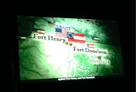
We went over to the Visitor's Center, saw a video and learned of Grant's victories at Fort Henry and Fort Donelson before heading toward his next objective at Corinth.  He landed his troops at Pittsburgh Landing (Shiloh).
After the video, we stopped at the bookstore, then walked over to the cemetery.
After a few minutes there, we were approached by a girl and her friend who asked if we would like to do a local newspaper photo op for them.  We were glad to do so and listened to a local tour guide who gave us some of the history of Shiloh and Corinth.
You can read the article here.  That was fun and an added bonus.

Next our driving tour where we tried to image the flow of the battle and skirmishes.
I always prefer a picture of how one side was pitched against the other.  As an intel analyst from my military days, we tried to present a snapshot of what the battle forces looked like.  As you can imagine, pretty wall map is a far different story than the reality of the chaos on the ground.

Shiloh was an critical location for the Union forces to secure in the bid for the important Confederate railroad junction at Corinth, MS 23 miles to the Southwest.  The battle at Shiloh was the beginning of a six-month siege at Corinth to take control of the railroad and supply centers.

I had started the book months ago but am currently in the process of finishing Personal Memoirs of U. S. Grant - (his autobiography).  Very interesting reading.  Grant was injured when his horse fell on him during the heavy rains and heat of the battle.  The battle at Shiloh (or Pittsburgh Landing) on the Tennessee River was the first major battle won in the Western Theater.

On April 6 and 7, 1862 Union forces (65,000) under U.S. Grant and D.C. Buell were surprised by those of A.S. Johnston and P.G.T. Beauregard (40,000).  Combined dead approached 24,000.  Hard to fathom what war is like if you've never been in one.  Union forces prevailed at Shiloh while the Confederates retreated toward Corinth.

After our driving tour around the battlegrounds, we had lunch under a big shade tree at what was once Pittsburgh Landing.
Then we were off to Corinth and our next museum.
Once we got to the Interpretive Center, we saw a number of artifacts embedded in the cement.
It was a unique way to build some curiosity.  And effective.

Inside, it was a collection of good displays and information that told the story of Corinth and its key role in the Civil War.

To the South, it was a vital distribution and supply point at a junction of rail lines going North and South (Ohio and Mobile Railroad) as well as another railroad route going East and West (Memphis and Charleston Railroad).

Confederate General P.G.T. Beauregard again suffered defeat from Union forces, this time under Gen
Henry Halleck.  However, he was able to pull off a hoax and escape in the night prior to the arrival of Union forces.  He boarded the Ohio and Mobile Railroad along with his soldiers, artillery guns and a large amount of supplies.
We walked through the museum and before departing for Red Bay in the late afternoon.  I think this is another one of those places I am going to have to visit again to digest the ebb and flow of battle and  the key events throughout the siege.

It was a great battlefield to see for the first time and I'm glad we took the time to spend some time there.  The National Park Service has done a nice job with it.  My main take away from this and Vicksburg the better understanding of Gen Grant and how he rose to prominence in the Civil War.  That has always been a mystery to me.

Thanks for joining us today on the Roadrunner Chronicles.  Until next time...