Pages

Showing posts with label historical markers. Show all posts

Wednesday, June 14, 2017

First in Flight

The motto on the North Carolina license plate motto is:  First in Flight.  I remember first reading that many years ago and thinking something like, "Really?  I thought the Wright Brothers were the first ones to fly an airplane."

Turns out they were and they did -- in North Carolina.

Pam and I took another druve from our campgrounds just inside the southern Virginia border.  Google maps said were only 47 miles from Kill Devil Hills and we took a drive down there.  We not only saw the National Memorial site at Kitty Hawk, but also had a nice lunch and did some shopping.  It made for a very nice middle-of-the-week day trip.

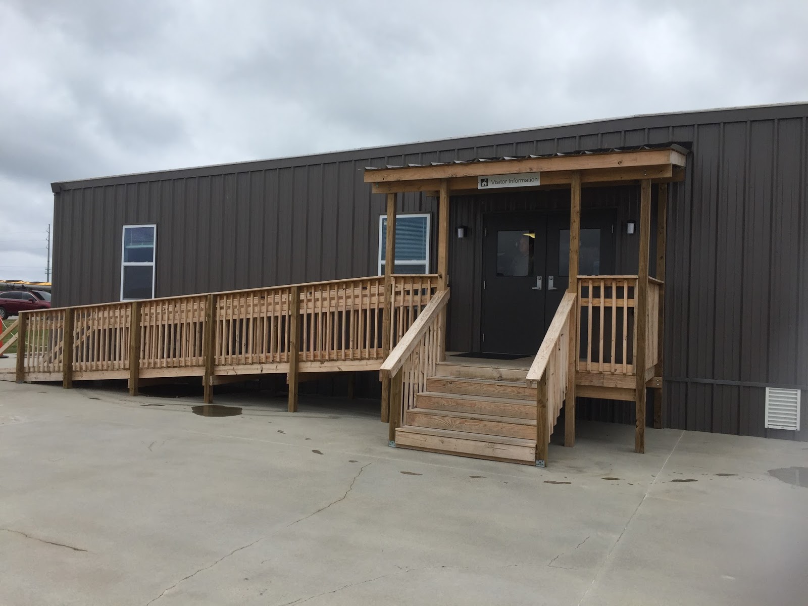
We drove up to the memorial site and found the visitor's center to be under renovation.
The building was built in the 1960's are apparently had a number of leaks that needed to be addressed.

The temporary restrooms and check-in point were well manned with knowledgable people and plenty of merchandise.
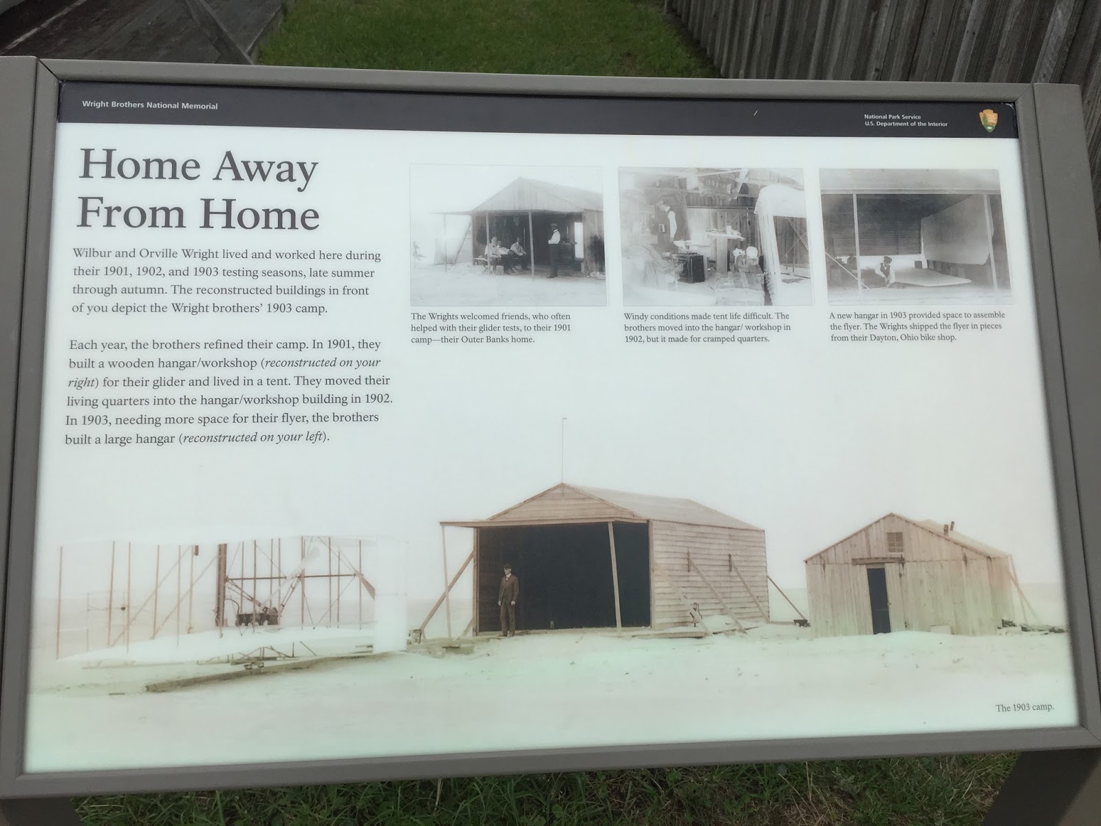
 We were more interested the warehouse/buildings that became the workshop and living quarters of Wilbur and Orville Wright.
This is were they parked their plane as it was being built and worked on.  This building also served as their home, where they slept in slings hung from the rafters.
The Park Ranger was telling their story. Though they had a successful bicycle business in Dayton Ohio, they were fascinated by the idea of flying.  Wilbur wrote the Smithsonian Institute in 1899 and inquired about literate on the subject.
Based on the information they received plus their inquisitive and engineering mindset, they developed their own theories of flight.  This is impressive since both young men did not finish high school.  Hard to imagine how they became inquisitive, self-taught scientists.  Clearly a different breed.  They experimented with various gliders and used Octave Chanute's design for a model of their own biplane.  In fact, they contacted him and were friends until his death in 1910.

I found this tidbit particularly interesting since I was born at Chanute AFB, in Rantoul, Illinois.  I don't know why, but I never looked up the significance of that name or why the AFB was named after him.  Now I know.

They picked the Kill Devils Hills area for their research and tests based on information from the U.S. Weather Bureau that described the high hills and good winds.  They visited Kill Devil Hills, NC from their home in Dayton Ohio in 1900.

From that point they regularly returned during the next four years.  They conducted months of testing and learning about glider flying  as they developed their thinking on wing design and mechanics.

Finally, in December 1903, they were ready to fly the plane.  Their first attempt on December 14 did not go too well and some repairs were necessary.  Then, three days later, they got the results they hope for.  They produced powered flight four times.  Adjustments were made after each flight and they knew they were on their way.

The National Memorial grounds are laid out to show the high point of the area where they launched over a thousand glider flights leading up to their first four powered flights.
 This stone marks their first of four flights on December 17, 1903 using a 12 horsepower, 180 pound engine.  They launched it from a single wooden rail. They flipped a coin, shook hands and Wilbur laid down on the craft.  With the noisy engine started, they flew four times that day:
    1. First flight:  lasted 12 seconds, went 120 feet
    2. Second flight:  12 seconds,  175 feet
    3. Third flight:  15 seconds, 200 feet
    4. Fourth flight: 59 seconds, 852 feet
At the other end of the grounds was a memorial on top of the high dune in the area.  Since the Wright Brother's arrival in 1900, the whole area was planted with grass to preserve dunes.  The site was designated for commemoration in 1927 by Calvin Coolidge and it was dedicated in 1932.   


 Orville Wright and Ameila Erhardt attended the dedication of the site.
At the back side of the memorial a bronze series of sculptures is used for a play ground.  It is based on the photograph of the Wright Brother's first powered flights.
They had a small group that day to help.  Less than ten people were there, including Wilbur and Orville.  And three people from the nearby Life Saving Station, one of whom they asked to take the photograph with the camera they set up for the occasion.

After seeing the memorial, we found a great place to have lunch:
Though it was a bit of an overcast day, we enjoyed it.  Our server, Hristina, added to our time there.
We arrived before the lunch crowd rush and had a few minutes to chat with her.  She's a summer worker from Macedonia with a very friendly way and told about her home country and life back there.  She's a graduate student and is in law school and has been coming to the Outer Banks for the last three summers.  

Next on the agenda was a stop at the Outlet Stores.  We don't often find bargins or things that we can't do with out but we did manage to get a new wallet and handbag.  

We also made stops at Starbucks and Walmart before the drive back and it was another great day trip.

Thanks for joining us on the Roadrunner Chronicles!  

Saturday, November 12, 2016

Looking for the Liberty Bell

Every state capitol was given a replica of the Liberty Bell in 1950.  When we visit state capitols, we always like to find out where it is located.

We were recently in Columbia, SC to visit the state capitol.  It is only about 8-9 miles from the campground where we stayed - the Army Travel Campground at Lake Weston Recreation Area.
Our drive from Fort Jackson Travel Campground to the downtown area was relatively short.  We found a parking lot about two blocks away and entered the grounds from what seemed like the "back" off of Pendleton Street.

The first statue we saw commemorated Civil War general and South Carolinian Wade Hampton III.  
The State House was originally located in Charleston and built in the 1750's./  In 1786, the capital was moved closer to the geographic center of the state.  It was the nation's first planned capital city.  Fire destroyed the first wood building and construction began in 1854.  Progress was slow got slower during the Civil War.  In fact, when General Sherman and the Union Army invaded the state in 1865, that State House was burned and badly damaged.
It took many years for construction and repairs to continue and it was declared completed in 1907.

Once inside the building, we made our way into a small auditorium along with a 3rd grade class on a field trip.  We saw an 11-minute orientation film which provided a good summary of the highlights of the state and the State House.
 Like many capital buildings, it has a dome in the center on the ground floor with four wings extending from the center.  It is on the small side but it was nicely decorated and designed.
The State House has an interesting dome.  In fact, it has an interior and exterior dome that do not exactly match up.  The interior dome is actually a "false interior" that was designed for aesthetic reason but is slightly off center from the exterior dome.
One of the tour guides pointed us to this poster which shows some unique features.  If you look hard enough you can see the smaller interior dome under the larger exterior dome and slightly off center.  Also, you can see bold lines and areas under the structure that are actually new pilings and modifications added during the 1995-1998 renovation.  When it was finished, it was the state's first retrofitted, earthquake proof building.

Looking down from the stairway of the second floor, you could see the main entry way and a statue of on the South Carolina's statesman:  John Calhoun.
At the top of the stairs we saw the main door of the House of Representatives. Unfortunately, it had a sign which indicated it was under construction and therefore we were not able to go inside.

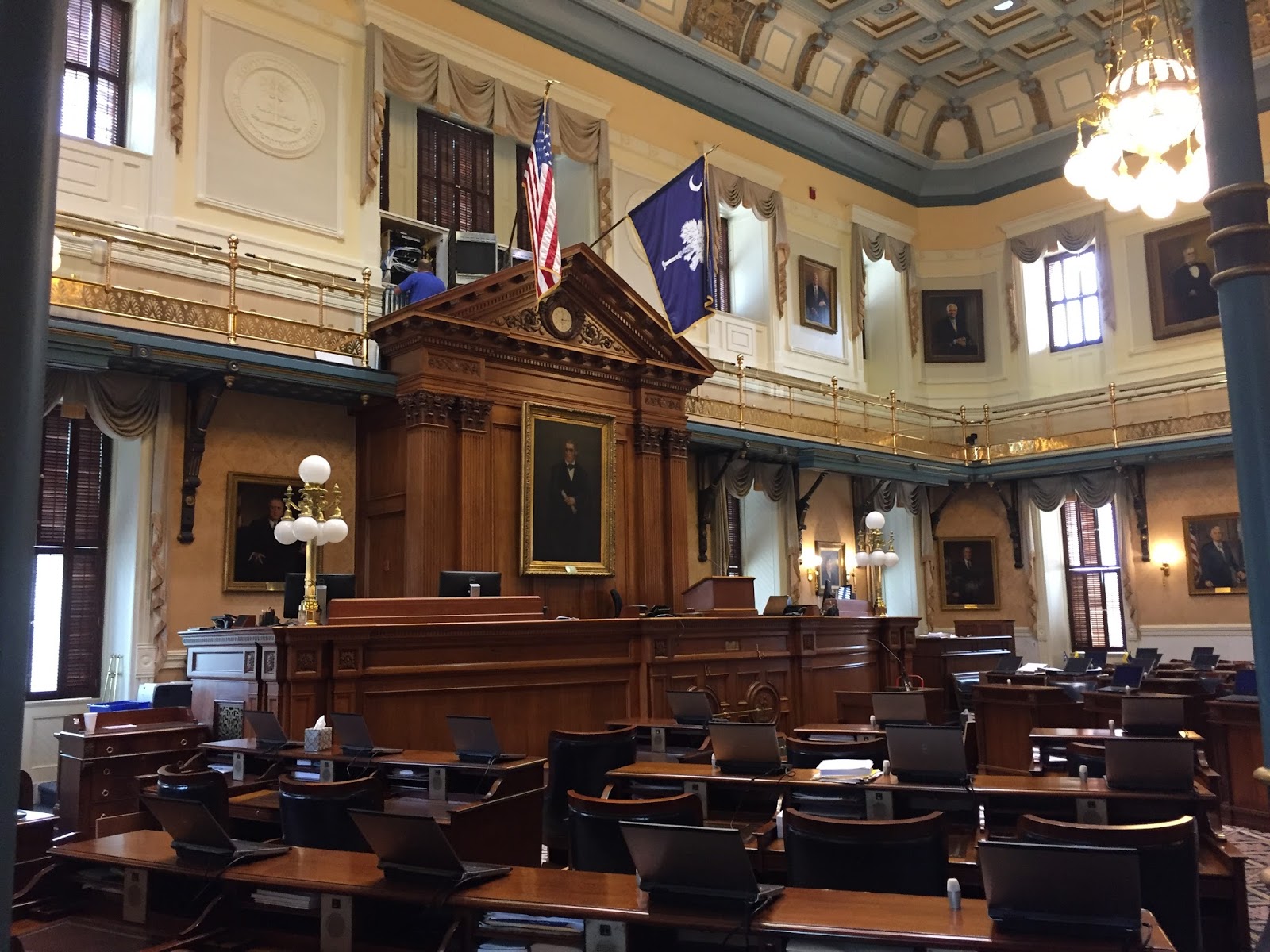
 Across on the opposite wing, we were able to see inside the Senate chambers.
The Senate chambers is where 46 districts are represented.  Each senator represents approximately 87, 000 South Carolinians.

After touring the inside we exited the building and walked around the other side of the grounds.
This is a view of the State House from the 'front' looking from down Main Street.  The statue in the middle is of George Washington.

U.S. Senator Strom Thurmond began representing the state in Washington in 1954 until 2002 when he was succeeded by Lindsey Graham.  Thurmond was the second longest serving member of the Senate.  He was there 48 years.
A statue of Strom Thurmond is in the back of the 18 acres of the capitol grounds.

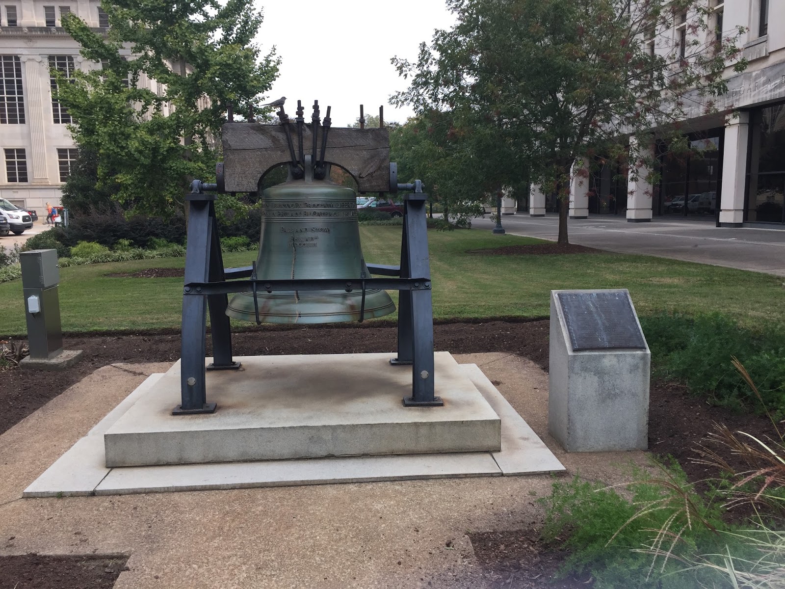
Not far away, we found the famous Liberty Bell.  Every state capitol has one and we enjoy looking to see where each had is displayed.  This was not far from the Thurmond statue on the capitol grounds.
The replica is one of 55 Liberty Bells that were sent to U.S. capitols, Washington D.C. and U.S. territories as part of a Savings Bond drive called, "Save Your Independence."

Another fun part of the day was meeting a fellow RVer in the orientation film.  He was there to see the state capitols and had been to 14.  Talking with him caused us to think about how many we have seen:
  • Arizona
  • California
  • Colorado
  • Florida
  • Georgia
  • Idaho
  • Iowa
  • Nebraska
  • New Mexico
  • Oklahoma
  • Oregon
  • Pennsylvania
  • South Carolina
  • Tennessee
  • Texas
  • Utah
  • Virginia
  • Wisconsin
  • Wyoming
It was fun to add another one to the list.  And we'll be seeing more on our trip south in the next few weeks.

Thanks for joining us today on the Roadrunner Chronicles!


Thursday, August 25, 2016

Little Bighorn National Monument Stop in Montana

After leaving Columbus MT, we wanted to stop at the Little Bighorn National Monument which was a couple hours along I-90.
It was a cloudy day with some rain, but we stopped anyway to see the museum and the grounds.
A national cemetery is on the site on one side of the main building.
Over time, I am learning more and more about the history of the American Indian and the U.S. Government's expansion through the Great Plains.  There were many reasons for encroachments west of the Mississippi, but the lure of a quick fortune meant trappers and fur traders, gold rushers and others looking for a place to homestead, meant treaties with the Indians were broken again and again.

The tensions between the Indians and the white man varied for a number of years, specifically between 1854-1890 in what was known as the Sioux Wars.  The Little Bighorn was one of those battles of the Sioux Wars.

I liked the small but well done museum.  It had a number of interesting artifacts and displays depicting life in the 1870s on the Plains.  The U. S. 7th Cavalry was dispatched to the territory to "get rid of the Indian problem" and Lt. Col. George A. Custer was among the 700 men who fought against approximately 2,000 Lakota Sioux, Cheyenne and Arapaho warriors.
Custer's Last Stand is the source of much speculation, contemplation and legend.  Since it was undoubtedly a complete rout, there were no eye-witness soldiers to substantiate different accounts.  But by most accounts, Custer's force was annihilated within an hour of engagement.

This internet map shows how the Army was positioned for a three pronged attack against the Indians gathering in the area.
It was the largest battle in the Sioux Wars of 1876.   Afterwards, the Indians divided up into smaller groups and dispersed because there was not enough grass and game to sustain the large number of forces that had gathered there.  This was the last significant battle of the Sioux Wars.  Afterwards, the Indians were chased and forced onto numbers of reservations where they were promised peace and rations and their own territory once again.

Among the displays was a display of key people at Little Bighorn including Custer, Major Reno, as well as Indians who served as scouts, guides and interpreters for the Army.

Sitting Bull inspired many of the Indians, including Crazy Horse to fight for their people.   Sitting Bull said to his warriors, "You are fools to make yourselves slaves to a piece of fat bacon, some hard tack and a little sugar and coffee."  Another leader of the day, President Ulysses S. Grant advocated the Peace Policy of 1869 which had little effect on the roaming Indians and the corrupt Indian Agents throughout the territory.

After slowly going through the museum we took a walk up the hill to separate memorials for the Army and Indians.
A monument was erected with the names of the Army fallen.
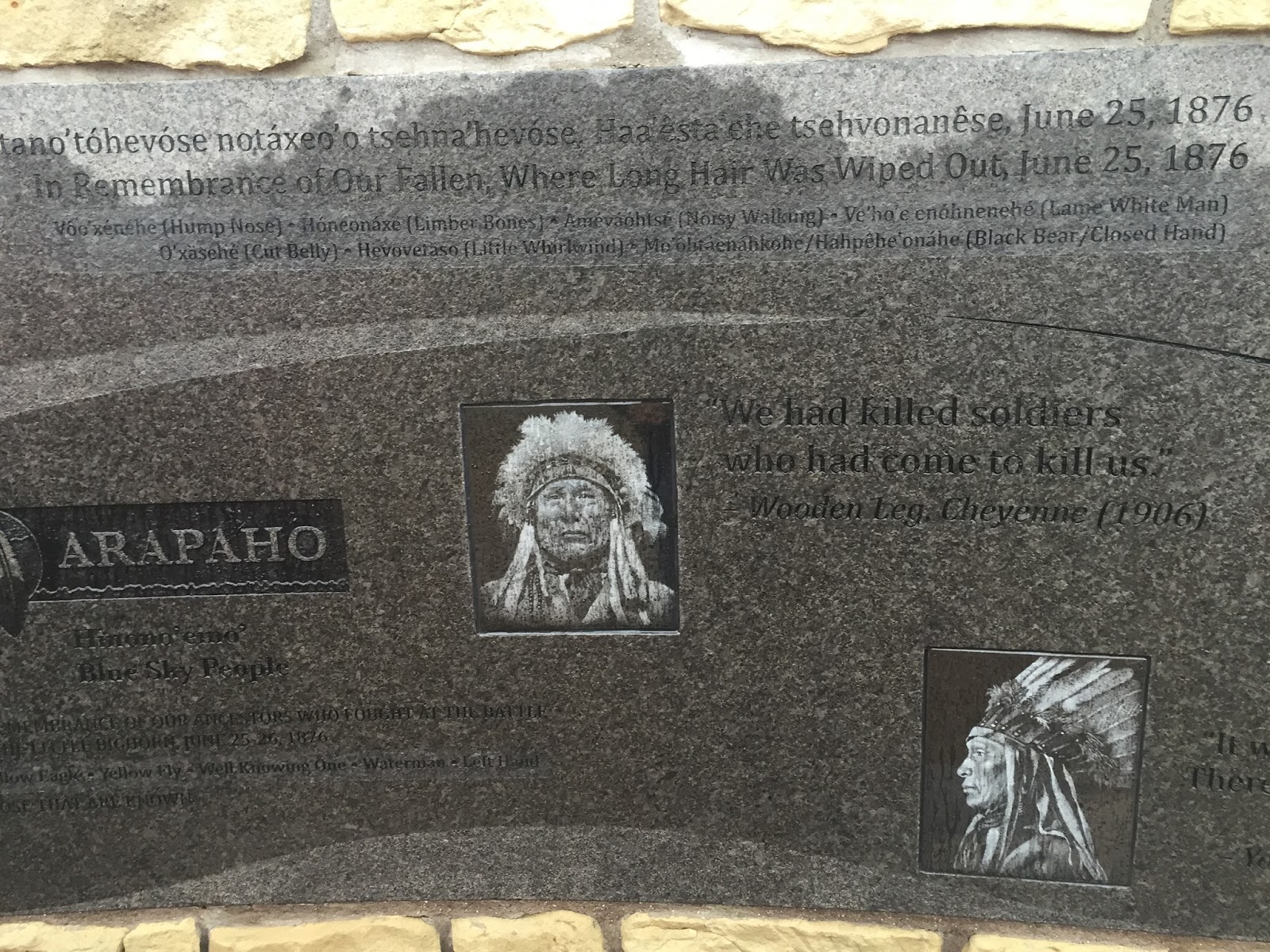
Across the way was a memorial built for the Indians.
It was worth the stop and we were glad we did.

Thanks for joining us on the Roadrunner Chronicles!


Saturday, August 6, 2016

Time in Portland - August 2016

We've been in Portland for almost three weeks for eye surgery.  That went well and I'm on the mend.  It's time to get back to some sense of normal so we decided to take a short excursions to get out and about.  We went into Portland one day and checked out the flagship store of Columbia Sportswear and found the Wells Fargo Museum downtown.

First we drove into town on a beautiful afternoon and found a parking garage a few blocks away from the store.
 It was not exactly huge, but still a good size store.  We looked for something we couldn't do without and came away with a new sun shade hat and a couple of little boy sun shirts.  The best thing about it was the huge discounts of 20% for military.  I had no idea Columbia was so generous.

That was fun, next we went over a few blocks and found the Wells Fargo History Museum.  The museum is actually a number of well-done displays in the very big lobby of the Wells Fargo Bank.  This is one of eleven such museums that Wells Fargo operates throughout the West.
Besides Butch Cassidy and the Sundance Kid, I always think of these majestic stage coaches when I think of Wells Fargo.  This beauty was an 1854 Concord Coach.

Wells Fargo was a key element in the California Gold Rush transporting gold and valuables all throughout the territory and beyond.
 I love the old pictures of how life was back in the 1860s.  This shows the dirt streets and stores of that era.
An hour was well spent going over all the displays and momentos.  It was a great way to spend some time walking around downtown and taking in a bit of history.

The next morning we took our time and left the Portland Fairview RV Park (which was a very good campground for us) and proceeded 18 miles east toward Multnomah Falls.  We'd seen it five years ago but wanted to go again.  The weather the last couple of weeks in the Portland area has been absolutely great!

Shortly out of town we noticed signs of a backup and slowdown.  Five miles of creeping along and we saw the reason.  A crane was onsite to help get this big 5th wheel out of a ditch.  Hard to say how that happened but it didn't look good.  Hope no one was hurt.
 Besides the accident, the DOT was getting some paving done so our 30 minute drive quickly turned into 60 minutes and counting.  We got off the freeway and took the Old Columbia Highway thinking it would be a little quicker.  The short cut turned into a long cut and our 18 mile drive turned into about a two hour deal.

Sometimes I am amazed how we do this to ourselves.  We know this is the tourist high season, but for some reason did not take that into account.  By the time we got near the Visitor Center there were no parking places to be had.  It was lunch time and people were not leaving.

We went past the falls, turned around and came back through the Visitor Center and Lodge area and still came up empty on a parking place.

We did however go past another falls in the area:  Horsetail Falls.  Beautiful stuff.
As we found out there are over 90 waterfalls in the Columbia River Gorge including this and Multnomah Falls.

A few miles later we turned around again went past the Lodge one more time and then continued past the Lodge again creeping along in traffic before we decided to get over to US Highway 84 and see if we could get into a larger parking lot in between the east and westbound lanes of the highway.

We had no problem there - it should have been our first choice.  It was a short walk to an under-the-highway path to the Visitor Center and Lodge.
These beautiful falls did not disappoint.  Descending 620 feet, the falls are Oregon's most visited attraction.  We had a great time there and had some lunch and an ice cream cone.  We got to meet some nice fellow-tourists from Minneapolis and another couple from Denmark with their three teenage girls on vacation.

Yesterday we also got out and ran some errands at Costco.  We took the back road (Marina Drive) that runs along the Columbia River.  There is a nice bike path and park and we came across a unique community.  This historical marker notes the farthest point the British traveled inland in 1792 from the mouth of the Columbia River and named it after explorer and British Naval Officer George Vancouver.

Farther west on down the river, we came upon a number of houses built on floating docks along the shore line in one area.
The small community looks well protected from the elements and sits peaceably along the banks of the Columbia River.

Those are some of the sights we've seen in the past few days.  We are enjoying the great weather and interesting place in the Portland area.

Thanks for joining us today on the Roadrunner Chronicles!