Pages

Showing posts with label National Historic Parks. Show all posts

Tuesday, October 11, 2016

Roadrunner Rerun: Camp River Dubois - More Lewis and Clark

The idea of 'Rerun' is more of my attempt at "taking a another run at this ("blog" as I will call them from this point forward although it is technically a post and not a blog...)."  I have started and not completed a lot of different ones over the years but want to go back and finish some.  For example, I've completed and published 1128 since 2008 and have 174 "in draft".  Here is one I wanted to complete:
------------------------
Lewis and Clark at Camp Dubois
We passed Oregon and and Washington in July and August of this year (2016).  We are fascinated by the Lewis and Clark Expedition (1803-1806) and have learned a lot more about it since we started RVing in 2009. This summer, after seeing the Oregon Coast, we made it a point to visit the site where Lewis and Clark actually first saw the Pacific Ocean.  Also about that time, I had a chance to complete Stephen Ambrose's "Undaunted Courage" while recuperating from retina detachment surgery.  It was an excellent read/listen (via Audible.com) and helped me learn more about their expedition.

The Lewis and Clark entourage ("Journey of Discovery") left the St. Louis area in May 1804. They began their expedition after training and getting outfitted for the journey at Camp Dubois (Camp Woods) which is not far from St. Louis and what is today Hartford, Illinois.  It was astonishing to me on a number of levels.  To me, this whole effort including the planning, preparation and execution of it (1803-1806) was like sending a man like sending a man to the moon in 1969.

The insight and education of Lewis was amazing.  He did a crash course in botany, medicine, politics,  Indian relations, hunting, fishing, survival, etc.  Additionally, he knew how to select and train men of a certain character and skill set that would serve the group well.  Above all, he had leadership skills that postured him for the arduous and unbelievable hardships he and his men faced.

Toward the end of our summer travels and the closer we got to the St. Louis area, the more we realized we wanted to find out about Camp Dubois.  We found an excellent place to do just that at the Lewis and Clark State Historic State Park.  This place is not far from the actual Camp Dubois site which was along the Missouri River.  The precise location of the camp is thought to be now in the middle of the river.  Over time, the course of the river has changed and now flows over the original encampment location.

When we arrived it was in the early afternoon and the Park was almost empty.  There were three volunteers (that we saw) running the place and the only other visitors were a couple plus Pam and me.
The small visitor center was deceiving - it has lots of great displays and information.
One thing the docent mentioned was how many places in America claim "to be the starting point of the "Journey of Discovery".  They themselves were as quoted as saying Camp Dubois was their departure point.

Lewis served with Clark at one time and when asked by President Jefferson to undertake the task, he picked his friend and former commander.  History records them to be one of the all-time most
effective duos in our nation's history.  They both worked very well together and complimented each other's strengths.
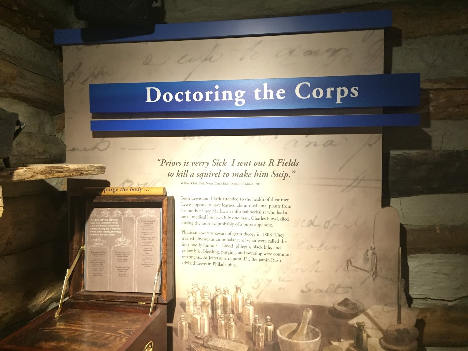
The visitor center did a good job of showing the different trades that the men needed for their journey. Both Clark and Lewis took part in selecting the men.  Of the 30+ that comprised the total, only about 20 ended up completing the entire expedition.  One man, Sergeant Floyd was lost due to illness with what was thought to be a ruptured appendix in the first year (1804) after they left Camp Dubois.
The second winter they stayed near what is present day Washburn ND.  They built was was known as Fort Mandan, named after the friendly and hospital Indians of the area who were helpful to them during the cold and brutal season.  The winter was harsh and they built the fort for protection from the elements and Indians.  This was the second of three forts(Camp Dubois, Fort Mandan and Fort Clatsop - near Astoria, Oregon.)

Here at the Historic Site, the building itself is unique.  This angle gives the idea of the bow of a boat.  Lewis and Clark made good use of a keelboat (also shown in pictures below) moving their supplies up down the Missouri River.
Also on the property is an old cabin that provides a little insight into what they might have looked like back in the early 1800s.
From a distance on the property, you can see a replica of Camp Dubois and the layout.
When we arrived we began going through the displays inside the Visitor's Center, but then got the offer of an outside tour with a docent which we did that.  Then we returned inside to see the rest of the museum. I thought the displays were well done.  They provide context and some chronology of what happen to whom and when.  I like that.
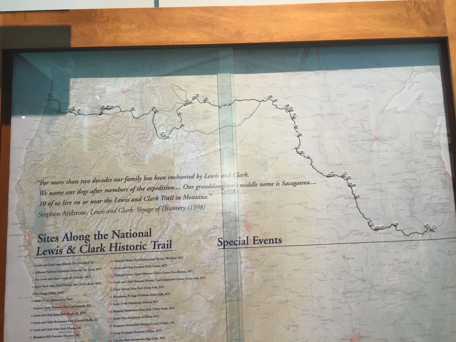
Surprising to me but, there are more than a dozen Lewis and Clark sites.  Way more -- in fact 53 to be exact as listed here.
I liked this map that gives a good idea of where they left Camp Dubois heading northwest to Fort Mandan and on to the Missouri River, over the Cascade Mountains and onto the Columbia River and out to the Pacific Ocean.  On the return trip, Lewis and Clark divided the men and split up for a time before joining back together and completing the journey.
The keelboat was very important to them and the museum had a cutaway replica of it.
This is a replica of a dugout canoe they used.
There was a lot to see and to absorb, but our stop at Camp Dubois (Lewis and Clark State Historic Park) was a good one.  Makes me want to see the other 50+ museums and sites.
Thanks for joining us today on the Roadrunner Chronicles!

Monday, August 11, 2014

Oh Say Can You See?

Though we've lived fairly close to Baltimore and Fort McHenry, we've never been to the National Historic Park.  It's really impressive!
I've never been to clear about the War of 1812, but this was an opportunity to learn more and put some more history into perspective.

The United States declared war on Britain and Ireland for a number of reasons including: the hijacking of U.S. sailors and forcing them into service aboard British ships (known as impressment);  support of Indians in war against the U.S. and blockading/restricting U.S. trade with France.  The British seemed to have the resources and momentum after burning down the White House and Washington D.C. in 1812.  But later the U.S. had finally had some key victories in New York and New Orleans and in Baltimore. The war lasted from 1812 to 1814 when the Treaty of Ghent was signed and then ratified by Congress in 1815.

In Baltimore, the British were getting ready to take out Fort McHenry and then Baltimore when Francis Scott Key was trying to effect a prisoner of war exchange.  He was on board a British ship just before the hostilities broke out and they held him until after the siege was over.  It was from a British ship that Key saw the flag through the fog and smoke of 25 hours under bombardment.  He penned what was originally called 'Defense of Fort HcHenry'.  It was adopted for use by the U.S. Navy and eventually became our National Anthem in 1931.

We loved our time at the Historic Site.  The displays in the Visitor Center were unique as was the fantastic video of the story behind Fort McHenry and the flag.
At the end of the video the double wide screen went up and through the picture window we saw the flag over the old fort.

It was quite moving when one, then two--then all of us stood up as the Star Spangled Banner blared over the speakers.  Great start to our visit.

Next we went outside and listed to a Park guide give a presentation on the flag.  This was an audience-participation event and we all got into it.

First we lined up into two lines then held the flag which is an exact replica of the one  being flown.
As we unrolled it and then rolled it back, the guide gave us quite an interesting history lesson.  For example the flag that was flown at the time had 15 stars and 15 stripes.  (Guess what states that symbolized? - the original 13 plus Vermont and Kentucky.)

As we moved around the grounds, we went over to the old fort itself.
The grounds and the rooms around the fort were very well maintained.

The fort was also used in other conflicts including as a hospital during the Civil War and World War 1 and as a training base.
The fort is right on the water which has changed its look over the years with industry near by.
But some interesting vessels still make their way down the Chesapeake.

Fort McHenry was a great stop and we enjoyed our afternoon there!
Thanks for joining us today on the Roadrunner Chronicles!


Monday, April 21, 2014

Grandeur of the Grand Canyon!

From the Cottonwood/Sedona area, we drove up to Flagstaff, AZ.  It is a short 90 miles to one of the world's most scenic locations:  The Grand Canyon.
I think this may have been my fifth or sixth visit.  Last one with our young 5 and 6 year olds in 1988. We camped at Mather campground in our first RV - our 1978 Volkswagon Westfalia.

This time we only got to spend the day there.

We left Flagstaff about 7:10 A.M. and were there by about 8:30 A.M.  We were expecting some rain but early on it looked bright and sunny.  When we arrived we went over to the Grand Canyon Visitor Center and got a map and the lowdown on the free shuttles.

We used to drive over to the scenic overlooks but now they are accessible by Shuttle Bus only.  But they have the system down.  It is about as easy as it gets.  Very organized and only a little bit of waiting.
Then the a short walk over to the rim to Maricopa Point and a view of Mather Point and Bright Angel trail down to the canyon floor.
This is where it initially became a little overwhelming.  The senses have a hard time comprehending it.  
I am seeing it but not quite sure how to process and absorb it all.

After a while we walked some more along the Rim Trail to Powell Point and Hopi Point.
And we went to Mohave Point, past The Abyss and took in the views at Pima Point.
After a couple of hours we finished up the Hermit's Rest Stop Route, changed buses to get back to the Grand Canyon Visitors parking lot, when it started raining.  We made it back just in time, had a picnic lunch and then went over to Verkamp's Visitor Center and took in some more views.
We also swung through the gift shop, found a some items we couldn't live without and then called it a day.

We made the 82 mile drive back to our Camp Tuthill Campground just outside of Flagstaff and were tired!  Chalk up another day in one of America's premier National Parks.

Thanks for joining us - until next time....

Friday, April 18, 2014

Montezuma Was Not Here

We visited  Tuzigoot National Monument, Montezuma Castle National Monument and Montezuma Well a couple of days ago.  They are all in the Verde Valley near Cottonwood AZ and the Dead Horse State Park where we are camped for a few days.
Tuzigoot is Apache for "Crooked Water" and is the name given pueblo ruins that were discovered in the 1930's.
Work crews under the supervision of archeologists uncovered a series of connected Singua structures that are the largest and best preserved buildings of its type.
From Toozigut, we drove over to Montezuma Castle which was about 25 minutes away.  It was much more crowded and it was time for lunch so we ate some sandwiches Pam prepared.  We do that more often than not -- fix some snacks and or lunch to take with us.

The name 'Montezuma Castle' was mistakenly attributed to the Aztec god by American settlers in the 1860s.  In fact, the grounds were abandoned by the Singua people 100 years before Montezuma was born.  But the name stuck.

We went through the Visitor's Center and .3 miles down the walkway to the back side of the cliff and saw the castle.  Pretty remarkable cliff dwellings.
As with the ruins at Toozigut, researchers and archeologists have gone back and 'reconstituted' the grounds to what it was probably like hundreds of years ago.  Sadly, erosion and souvenir seekers have done a lot of damage over the years and it has been restored to what it probably like.

The Singua people, northern Arizona cousins of the Hohokam, built these prehistoric dwellings (circa 1400 A.D.) near the Beaver Creek.  Rooms here were thought to be as large as able to accommodate 45-50 people.
Teddy Roosevelt made it a National Monument in 1906.  Early visitors could climb ladders and actually walk around in the room but that was discontinued in 1951.

It was quite an impressive area and one that our family came to see on a day trip back in the 1960's.   As an 8 or 9 year old, I don't remember too much about it except we used to have some black and white photographs of it.

On the walk back to the Visitor Center, we stopped in and looked around the displays which we always try to do.

Then we were off to see the Montezuma Well which was another 15 minutes down the road.  This display was a self-guided walk of about a mile to the well and the river on the other side of the hill.
This unique site is where 1.5 million gallons of water emerge each day from an underground spring.  The pool of water that is created is about 10 times that amount.  In the underside of the cliff wall, you can see more cliff dwellings and what is thought to be almost 50 rooms that were inhabited by the Singua peoples.
Down the way from the well is a walkway to the river and a canal that has been rebuilt many times over the hundreds of years since the original inhabitants built it.
By the time we finished the walk, we were ready to go back to the campground.  Some times it takes some practice and a personal approach to viewing and trying to digest so much historical information.   Part of the reason for my blogging about these sights is to note it and remember what we say.

The National Park Service and volunteers have done a good job in this area of depicting an explanation of history and sure make it easy for tourists like us to enjoy another great outing!

Thanks for joining us today on some of Montezuma's? old stomping grounds.